How to Choose an RTK Base Station for Drone Mapping (2026)
Seven questions that separate a base you will love from one you will fight — coverage, convergence, links, logging and cost.
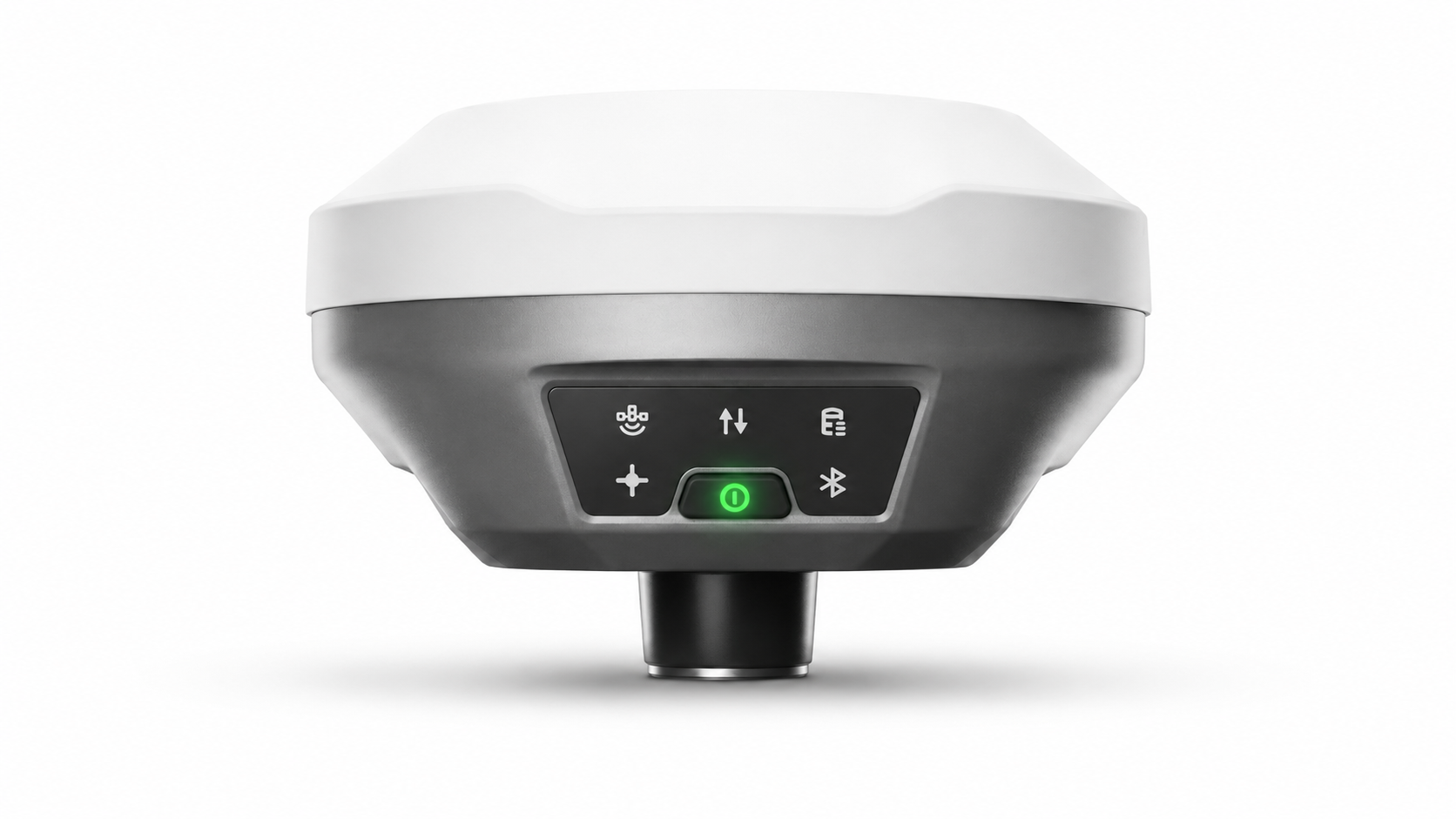
The 2026 market at a glance
The RTK base station market splits into recognizable families. Emlid's Reach RS4 and RS3 (with the RS2+ below them) built the accessible-surveying category: all-band GNSS, LoRa and UHF radios, the free Emlid Caster and Emlid Flow app, and a documented base workflow for DJI, Autel, Wingtra, and Skydio aircraft. DJI's own D-RTK 2 Mobile Station and D-RTK 3 Multifunctional Station integrate natively with the Matrice and Mavic Enterprise ecosystems over OcuSync, adding relay and rover modes in the D-RTK 3. The classical survey majors — Trimble (R750 and the R-series with CenterPoint RTX and VRS Now), Leica (GS18 T/I with SmartNet), CHCNAV (i73+, i93, and the PointSky satellite service), and South (Galaxy G-series) — sell survey-grade receivers that double as bases inside their software ecosystems.
Every one of these is competent hardware. The differences that matter live in three questions buyers rarely see on spec sheets: how the base learns its own position, what it costs to keep corrections flowing, and how many of your machines can drink from it.
Question 1–3: how does the base get its coordinates?
This is the decisive question. A base is only as accurate as its own position — every rover inherits it. The market offers four answers. Known point: centimetre-perfect if a surveyed monument exists on site; increasingly rare off the beaten path. Averaged single point: every vendor supports it (Emlid Flow's average-in, DJI's single-point mode at a specified 1.5 m horizontal uncalibrated); fine for relative work, a trap for anything that must overlay other data. Network calibration: the D-RTK 3 route and common practice with survey receivers — accurate, but it imports the CORS dependency, subscription and coverage limits included. Self-converging PPP: the base computes its own absolute position from L-Band satellite corrections — about 1.5 cm horizontal / 3 cm vertical in roughly 3 minutes with UAV Mate, similar in spirit to CHCNAV's PointSky (2.5 cm in 3–5 minutes on the rover side) and Trimble's CenterPoint RTX. If your sites lack monuments and coverage, this fourth answer is the one that removes fieldwork rather than relocating it.
Ask two follow-ups. Which frame do coordinates come in — ITRF2020 with a documented epoch (transformable to any national datum), or an averaged position in no particular frame? And is the accuracy absolute or relative — a distinction our accuracy guide unpacks with worked examples.
Question 4–5: how do corrections get out, and to whom?
Format first: insist on RTCM 3.x output. It is the open standard every RTK rover of the last decade consumes — DJI aircraft via Custom Network RTK, Emlid and CHCNAV and South and Trimble and Leica rovers, agricultural auto-steer, machine control. Proprietary-only correction paths shrink your future options.
Transports second, because sites differ: an internal UHF radio (note that 1–2 W transmit typically requires a licence in the US — Trimble's R750 documentation is explicit about FCC licensing); LoRa in Emlid's ecosystem for licence-light short links; 4G NTRIP for unlimited range under cellular; and drone RC-link passthrough for zero-hardware aircraft feeds. A base offering radio + NTRIP + RC link covers effectively every layout — the trade-offs are mapped in our correction-path guide. Confirm simultaneous multi-rover broadcast too: one base feeding a drone, two tractors, and a rover at once is where the economics get interesting.
Question 6: will it survive your field reality?
Ingress protection of IP67–68 separates equipment that shrugs off dust storms and downpours from equipment that visits the service centre (D-RTK 2 is IP65; most survey-grade units are IP67+; UAV Mate is IP68). Battery: a real field day is 8–10 hours — check the base-mode figure, not the rover figure, and whether USB-C external power can run it indefinitely. Weight and setup: a 3+ kg receiver plus tripod, tribrach, and case is a different logistics animal from an 827 g unit that sits on the ground; if your crews hike, fly light aircraft, or simply value minutes, tripod-free operation is not a gimmick. Finally, RINEX logging: raw observation logging at 1 Hz for PPK backup should be a checkbox, not an accessory.
Question 7: what does three years actually cost?
Total cost of ownership hides in the corrections column. Model it per rover, per year: network RTK subscriptions (several hundred to a few thousand dollars each, times every drone, tractor, and rover) versus a one-time base purchase plus, for PPP-based units, a single annual correction service that feeds unlimited rovers. Add the invisible lines: mobilization time to establish control at uncovered sites, GCP campaigns a self-positioned base eliminates, and reflights caused by FLOAT missions on marginal network links. For a one-rover urban operation the subscription model can genuinely be cheaper; from the second rover — or the first remote site — the owned-base model usually crosses over within a year (worked comparison in Satellite PPP vs CORS).
Matching the buyer to the base
| You are | Sensible fit | Why |
|---|---|---|
| DJI-only pilot, urban coverage | Network RTK or D-RTK 3 | Native Pilot 2 integration; coverage assumed |
| Mapping firm, mixed sites | Self-converging PPP base | Absolute coordinates anywhere; feeds all brands via RTCM 3.x |
| Survey office with legacy control | Trimble / Leica / CHCNAV receiver as base | Deep software ecosystems; localizes to monuments |
| Budget field crew, short links | Emlid Reach RS4 kit | LoRa/UHF, free Caster and Studio; known-point or averaged base |
| Farm or earthworks fleet | PPP base + UHF broadcast | One correction source for every machine, no per-rover fees |
Whatever you shortlist, run one field test before buying: set the candidate up cold at a site with no control and no coverage, time how long until a rover reports FIX with coordinates you could defend, and note every account, cable, and credential the process demanded. The base that wins that test wins the next three years.
Ecosystem lock-in: the quiet variable
Hardware is one purchase; ecosystems are a decade. DJI's stations reward all-DJI fleets and reach their best inside Pilot 2, Terra, and OcuSync; step outside and options narrow. Emlid's value is inseparable from Flow, Caster, and Studio — excellent free software, but the base-position question remains yours to solve. Trimble, Leica, and CHCNAV bases assume you live in Access, Captivate, or LandStar, with correction services (VRS Now, SmartNet, PointSky) sold alongside. A standards-first base — RTCM 3.x out, NTRIP and radio transports, RINEX logs — is the least romantic option and the most future-proof: it treats every rover you will ever buy, from any brand, as a first-class citizen. When fleets mix brands — and successful operations always end up mixing — the standards-first choice is the one still working unmodified.
A useful thought experiment: imagine replacing every other component of your kit over five years — new drone brand, new rover, new software. Which base candidates survive that churn without a firmware plea or an adapter? Buy that one.
Red flags in spec sheets
Four patterns deserve suspicion. Accuracy quoted without conditions — “centimetre accuracy” that turns out to mean relative accuracy from an averaged position. Base battery life quoted in rover mode — base transmit duty is heavier; demand the base-mode number. “Works with all drones” that on inspection means one NTRIP path requiring continuous internet. And correction services priced per rover buried in a footnote — the line item that dominates three-year cost. None of these are lies; all of them reshape the purchase once surfaced. The seven questions in this guide exist precisely to surface them before the invoice does.
A one-page shortlist worksheet
Print this and fill it per candidate: (1) Base self-positioning method and absolute accuracy, with frame and epoch. (2) Correction formats out — RTCM 3.x version and messages. (3) Transports — UHF power and licensing, LoRa, NTRIP caster/server, RC-link. (4) Simultaneous rovers supported. (5) Base-mode battery hours and external power range. (6) IP rating and weight with everything attached. (7) RINEX logging rate and storage. (8) Three-year cost: hardware + services × rovers. (9) The cold-site test result: minutes from box to defensible FIX. Nine lines, and the marketing haze burns off every time.
One-line takeaway
Judge a base by how it establishes its own absolute position, what its corrections cost per rover over three years, and whether standard RTCM 3.x lets every machine you will ever own drink from it — the rest is packaging.
Frequently asked questions
What is the single most important spec on a base station?
Not a spec — a capability: how the base determines its own absolute position. Everything downstream (repeatability, overlay, datum integrity) inherits from it.
Do I need an FCC licence for the radio?
In the US, transmitting on 410–470 MHz UHF at survey power levels generally requires an FCC licence; vendors such as Trimble state this explicitly for the R750. LoRa and RC-link paths avoid it; check your jurisdiction.
Can one base serve drones and ground machines together?
Yes, if it broadcasts standard RTCM 3.x. A single stream can feed DJI aircraft, auto-steer tractors, machine control, and survey rovers simultaneously.
Is a used survey receiver a good budget base?
Often, if you have known points and its software ecosystem. If you need self-established absolute coordinates at uncontrolled sites, budget instead for a PPP-converging unit.
Centimetre RTK. No CORS. Anywhere.
UAV Mate is a self-converging PPP/RTK base station: 1.5 cm ITRF2020 coordinates in minutes, broadcast to any RTCM 3.x drone or rover.
See UAV Mate